The Economist magazine highlights SSCI's GPS-denied navigation solution, ImageNav
December 6, 2016 | by SSCI
December 6, 2016 | by SSCI

Despite their successful implementation during the first Gulf War, map-based-cruise-missile-guidance systems eventually gave way to the more advanced and affordable approach that GPS provided. But critical dependencies with GPS are now motivating some to give map-based guidance systems a double take. Enter SSCI’s ImageNav, which looks to usher in a new generation of smart weapons with even greater precision and reliability.
By The Economist
Bombs that can recognize their targets are back in fashion
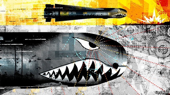
A new generation of smart weapons is in development IT IS easy to forget, given the ubiquity of satellite-navigation devices in cars and mobile phones, that the Global Positioning System (GPS) of orbiting satellites on which they rely was originally—and, indeed, remains—a military technology. The system is, for instance, relied upon by the JDAM (joint direct-attack munition) kits that America’s air force attaches to its free-fall bombs to turn them into smart weapons that can be guided with precision to their targets.
But JDAM and similar systems work only when they can receive signals from GPS satellites. And such signals are weak—approximately as powerful as a standard television transmission would be if the transmitter were five times as far away as the Moon is. They are thus easily jammed. For obvious reasons, details of the capabilities of jammers are hard to come by, but a Russian system called Pole-21, for instance, may be able to suppress GPS signals as much as 80km (50 miles) away.
One way to get around this—and to guide weapons automatically to their targets without relying on satellites—is to give weapons a map. That has been done in the past. The cruise-missile guidance systems which came to public attention in 1991, during the first Gulf war, worked in this way. But it was the Gulf war that also saw the first large-scale use of GPS by ground troops, and it is GPS, cheaper and simpler than map-based guidance, that has subsequently dominated the business of automatic navigation. Until now, that is. For the world’s armed forces are looking again at giving their bombs and missiles map-reading capabilities.
Where the hell are we?
America’s original map-based cruise-missile guidance system came in two parts. The first, Terrain Contour Matching or TERCOM, took a missile to the general area of its target using a radar altimeter and a series of digital maps that showed the elevation of the ground under sections of the planned route. By comparing the missile’s actual altitude above this terrain with its expected altitude, TERCOM could follow contours and find its way. Once it was close to the target, a second system, the Digital Scene Matching Area Correlator (DSMAC), compared the view from a video camera with a set of stored images, in order to locate the bullseye.
Such a combined system was awkward and expensive, but at least it was the best available before GPS. Now, though, huge improvements in electronics have turned the tables. Israel is in the forefront, with a system which it calls Spice. Like JDAM, Spice is an add-on kit that turns unguided bombs into smart ones. It is designed and built by Rafael Advanced Defense Systems, an Israeli weapons company, and comes into service this month.
Spice contains an “electro-optical scene matching system” that resembles DSMAC’s in as much as its memory is loaded with pictures of the target area, taken beforehand by aircraft (piloted or unpiloted) or by satellite. Spice’s pictures, though, are of much higher resolution than those of DSMAC. On top of this the cameras that generate the real-time images with which those pictures are compared as the bomb falls towards its target work both in the visible and the infra-red parts of the spectrum. That means Spice can operate in darkness, and can penetrate smoke and fog. Moreover, unlike DSMAC, Spice stores enough data to cover the entire route to a target. It has no need of an accompanying system similar to TERCOM. Instead, it picks out and compares, en route, features like roads and buildings to find its way.
Spice’s claimed performance is impressive. Rafael says it can guide a bomb released 100km from a target to a strike point within two metres of that target. The firm says, too, that its device is not confused by minor changes in the scenery around a target, which it can find even if some nearby areas have been obscured—say, by camouflage. Spice also has the advantage over GPS-guided weapons of working when a target’s exact position is unknown, or if the co-ordinates have been misreported. All you need is a picture of what is to be hit, and an approximate location, for Spice to find and hit it.
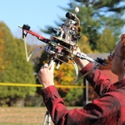
Other countries, in particular America, are following Israel’s lead. In January of this year, America’s air force signed a contract with Scientific Systems, a firm in Woburn, Massachusetts, to develop what that company calls its Image-Based Navigation and Precision Targeting (ImageNav) system. Like Spice, this is a bolt-on system that works by comparing images from a camera with those in a database on board. If all goes well, development and testing should be completed by January 2018 and the result will, its makers hope, be able to strike within three metres of its intended target. The initial plan is to fit ImageNav to the air force’s Small Diameter Bomb, a free-fall weapon at present guided by GPS. If this is successful, deployment on cruise missiles and drones will follow.
Meanwhile Lockheed Martin, the world’s biggest aerospace firm, is working on an optical-navigation system called Northstar. This is based on a piece of non-military software called Hydra Fusion, which was developed by Lockheed Martin’s Canadian subsidiary. Hydra Fusion creates a high-resolution, three-dimensional terrain map from ordinary video, by comparing successive frames of that video in light of information about how fast the vehicle carrying the camera was travelling. Though this is a trick which has been managed in the past, Hydra can do it on the fly, on a laptop computer. Previous systems have required hours of processing on high-end machines.
Once an area has been mapped, Northstar provides precise navigation information for bombs or missiles (or, indeed, for manned or unmanned aircraft). Crucially, the intelligence can be fresh because of the system’s rapid processing time.
Fitting bombs and missiles with vision in this way thus looks like the future. That does not mean GPS will not be used as well—a belt-and-braces approach is often wise in war. But bombs that can see their targets, rather than blindly following their noses to a set of co-ordinates, are always likely to have the edge.
This article appeared in the Science and technology section of the print edition under the headline “The vision thing.” To be taken to the original article, please click here.
Scientific Systems advances the possibilities of mission autonomy through pioneering innovations in navigation, mission planning and autonomous systems. Our solutions enable unmanned systems to implement commander’s intent, ensure mission effectiveness, and dramatically shorten operational timelines.
Transition Division ISO 9001:2015 Certified

 SSCI is developing algorithms for swarming UAVs to counter anti-access/area...